ANTWERPEN (BE) - 2016-02-28 20:36:51
- Magnitude 0.0
Last update : 2016-11-24 10:22:08 Belgian time
Main parameters
| Date and time |
2016-02-28 20:36:51 UTC
2016-02-28 21:36:51 Belgian time |
| Type | Suspected mine explosion |
| Magnitude | ML 0.0 |
| Maximal intensity | III |
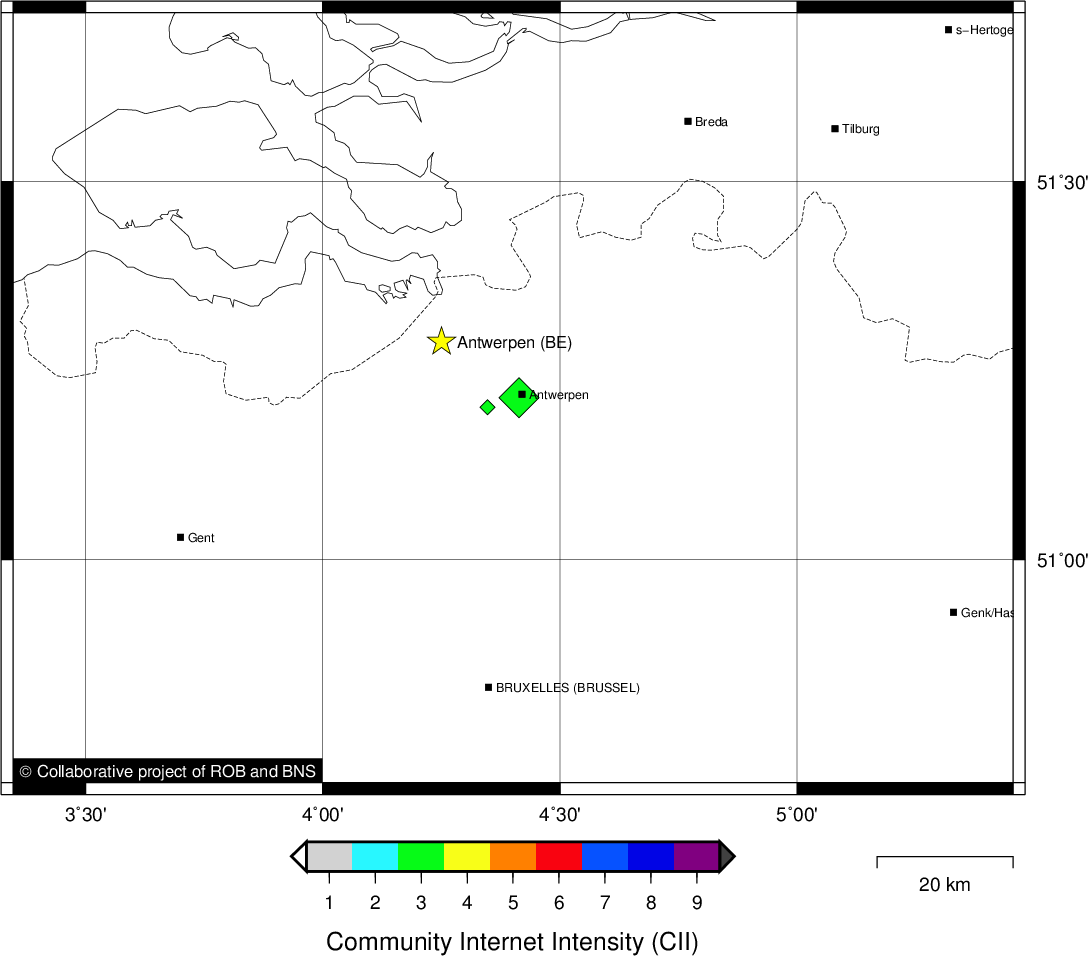
| Region | ANTWERPEN (BE) |
| Epicentral coordinates | 51.289° N, 4.251° E Uncertainty ± 1.9 km |
Data source : ROB (Royal Observatory of Belgium)
Location map
Quake measurements
Measurements by the Belgian seismic network
| Station | Epicentral distance (km) |
P-Wave arrival (hh:mm:ss.ss) | S-Wave arrival (hh:mm:ss.ss) | Maximal ground displacement (nm) |
|
|---|---|---|---|---|---|
| Code | Place | ||||
| MOLT | MOL | 59 | 20:37:01.64 | - | - |
| SKQ | STEENKERQUE | 72 | 20:37:03.73 | - | - |
| SNF | SENEFFE | 87 | 20:37:06.65 | - | - |
| ZEV | ZEVEKOTE | 96 | 20:37:07.99 | - | - |
| MRD | MAREDSOUS | 116 | 20:37:11.50 | - | - |
| GES | GESVES | 117 | 20:37:11.56 | - | - |
| CLA | CLAVIER | 122 | 20:37:12.51 | - | - |
| DOU | DOURBES | 135 | 20:37:13.78 | - | - |
| RCH | ROCHEFORT | 144 | 20:37:15.38 | - | - |
| MEMH | MEMBACH | 145 | 20:37:15.89 | - | - |
| TNL | TERNELL | 153 | 20:37:17.42 | - | - |
| MRG | MONT RIGI | 155 | 20:37:17.71 | - | - |
| WLF | WALFERDANGE | 226 | 20:37:26.50 | - | - |
Macroseismic
Data
| Total number of responses | 54 |
|---|---|
| Intensity I | 10 |
| Intensity II | 4 |
| Intensity III | 21 |
| Intensity IV | 16 |
| Intensity V | 2 |
| Intensity IX | 1 |
Attention! The intensities derived from the macroseismic enquiry are raw unverified data.
Map
Data policy
Please read on this notice to learn more about our data policy.