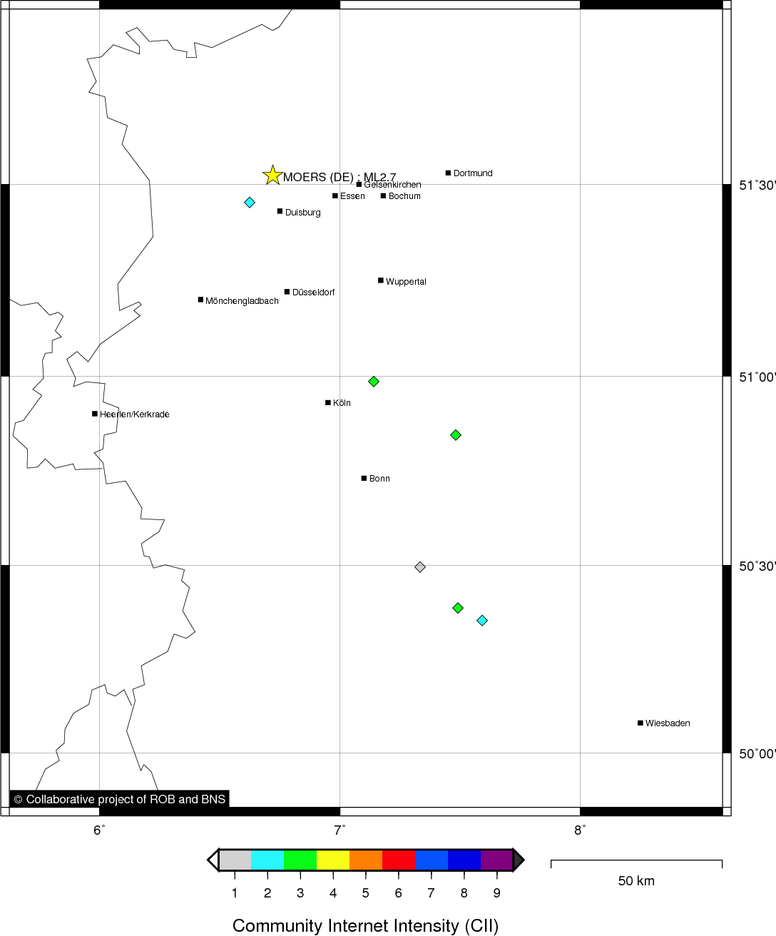
MOERS (DE) - 2011-02-11 15:40:05
- Magnitude 2.7
Last update : 2011-03-25 10:27:31 Belgian time
Main parameters
| Date and time |
2011-02-11 15:40:05 UTC
2011-02-11 16:40:05 Belgian time |
| Type | Known induced event |
| Magnitude | ML 2.7 |
| Region | MOERS (DE) |
| Epicentral coordinates | 51.523° N, 6.721° E Uncertainty ± 18.4 km |
| Depth of hypocenter | 10.0 ± 10.0 km |
Data source : ROB (Royal Observatory of Belgium)
Location map
Quake measurements
Measurements by the Belgian seismic network
| Station | Epicentral distance (km) |
P-Wave arrival (hh:mm:ss.ss) | S-Wave arrival (hh:mm:ss.ss) | Maximal ground displacement (nm) |
|
|---|---|---|---|---|---|
| Code | Place | ||||
| MEMS | MEMBACH | 113 | 15:40:22.31 | - | - |
| MEMH1 | MEMBACH | 113 | 15:40:22.38 | - | - |
| CLA | CLAVIER | 158 | 15:40:29.07 | 15:40:46.90 | - |
| GES | GESVES | 171 | 15:40:32.72 | - | - |
| RCH | ROCHEFORT | 185 | 15:40:35.98 | - | - |
Macroseismic
Data
| Total number of responses | 6 |
|---|---|
| Intensity I | 1 |
| Intensity II | 2 |
| Intensity III | 3 |
Attention! The intensities derived from the macroseismic enquiry are raw unverified data.
Map
Data policy
Please read on this notice to learn more about our data policy.