LONNIG (DE) - 2012-11-15 16:40:24
- Magnitude 2.0
Last update : 2013-05-24 14:11:14 Belgian time
Main parameters
| Date and time |
2012-11-15 16:40:24 UTC
2012-11-15 17:40:24 Belgian time |
| Type | Earthquake |
| Magnitude | ML 2.0 |
| Region | LONNIG (DE) |
| Epicentral coordinates | 50.318° N, 7.416° E Uncertainty ± 0.9 km |
| Depth of hypocenter | 10.3 ± 1.2 km |
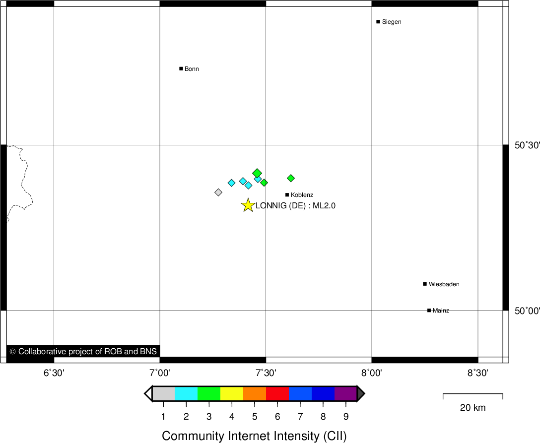
Location map
Quake measurements
Measurements by the Belgian seismic network
| Station | Epicentral distance (km) |
P-Wave arrival (hh:mm:ss.ss) | S-Wave arrival (hh:mm:ss.ss) | Maximal ground displacement (nm) |
|
|---|---|---|---|---|---|
| Code | Place | ||||
| HOU | HOUVEGNEZ | 100 | 16:40:40.79 | 16:40:53.25 | - |
| MEMH | MEMBACH | 105 | 16:40:41.80 | 16:40:55.02 | - |
| MEMS | MEMBACH | 105 | 16:40:41.83 | 16:40:54.67 | 22.3 |
| WLF | WALFERDANGE | 116 | 16:40:42.78 | 16:40:57.26 | 17.3 |
| EBN | EBEN-EMAEL | 134 | 16:40:46.44 | 16:41:02.41 | - |
| CLA | CLAVIER | 151 | 16:40:48.89 | 16:41:06.09 | 14 |
| RCH | ROCHEFORT | 157 | 16:40:49.36 | - | - |
| GES | GESVES | 166 | 16:40:49.99 | - | - |
| MRD | MAREDSOUS | 188 | 16:40:54.74 | 16:41:16.18 | 15.8 |
| DOU | DOURBES | 203 | 16:40:57.07 | 16:41:18.87 | 19 |
Measurements by the German seismic network of Bensberg (University of Cologne)
| Station | Epicentral distance (km) |
P-Wave arrival (hh:mm:ss.ss) | S-Wave arrival (hh:mm:ss.ss) | Maximal ground displacement (nm) |
|
|---|---|---|---|---|---|
| Code | Place | ||||
| BGG | BURG ELTZ | 14 | 16:40:27.45 | 16:40:29.17 | - |
| KOE | KÖPPEL | 25 | 16:40:29.08 | 16:40:32.07 | - |
| STB | STEINBACHTALSPERRE | 51 | 16:40:33.40 | - | - |
| HIL | HILLESHEIM | 53 | 16:40:33.56 | 16:40:39.98 | - |
| BNS | BENSBERG | 74 | 16:40:37.18 | 16:40:45.28 | - |
| HOB | HOHBUSCH | 74 | 16:40:37.21 | - | - |
| KLL | KALLTALSPERRE | 86 | 16:40:38.78 | - | - |
| DRE | DREILÄGERBACH | 92 | 16:40:39.99 | 16:40:50.82 | - |
| LAU | LAUPENDAHL | 120 | 16:40:44.37 | - | - |
Macroseismic
Data
| Total number of responses | 9 |
|---|---|
| Intensity I | 1 |
| Intensity II | 4 |
| Intensity III | 4 |
Attention! The intensities derived from the macroseismic enquiry are raw unverified data.
Map
Data policy
Please read on this notice to learn more about our data policy.