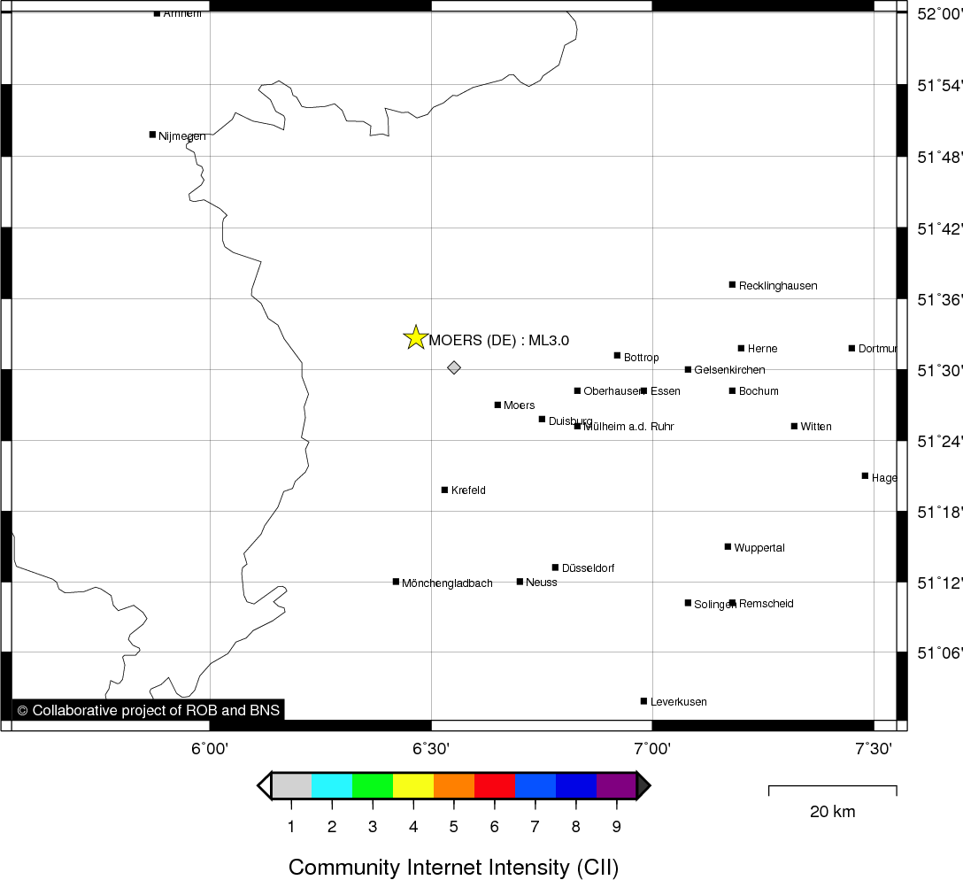
MOERS (DE) - 2011-06-22 10:44:22
- Magnitude 3.0
Last update : 2012-08-03 16:45:50 Belgian time
Main parameters
| Date and time |
2011-06-22 10:44:22 UTC
2011-06-22 12:44:22 Belgian time |
| Type | Known induced event |
| Magnitude | ML 3.0 |
| Region | MOERS (DE) |
| Epicentral coordinates | 51.545° N, 6.466° E Uncertainty ± 6.0 km |
| Depth of hypocenter | 10.0 km |
Data source : ROB (Royal Observatory of Belgium)
Location map
Quake measurements
Measurements by the Belgian seismic network
| Station | Epicentral distance (km) |
P-Wave arrival (hh:mm:ss.ss) | S-Wave arrival (hh:mm:ss.ss) | Maximal ground displacement (nm) |
|
|---|---|---|---|---|---|
| Code | Place | ||||
| MEMH | MEMBACH | 109 | 10:44:39.36 | - | - |
| DSLB | DESSEL | 103 | 10:44:40.72 | - | - |
| EBN | EBEN-EMAEL | 100 | 10:44:40.77 | - | - |
| MOLT | MOL | 103 | 10:44:40.83 | - | - |
| CLA | CLAVIER | 149 | 10:44:46.37 | - | - |
| WLF | WALFERDANGE | 211 | 10:44:56.36 | - | - |
| RCH | ROCHEFORT | 178 | 10:45:10.95 | - | - |
| SKQ | STEENKERQUE | 194 | 10:45:15.11 | - | - |
Macroseismic
Data
| Total number of responses | 1 |
|---|---|
| Intensity I | 1 |
Attention! The intensities derived from the macroseismic enquiry are raw unverified data.
Map
Data policy
Please read on this notice to learn more about our data policy.