OCHTENDUNG (DE) - 2011-08-05 09:29:36
- Magnitude 2.2
Last update : 2011-08-22 08:28:12 Belgian time
Main parameters
| Date and time |
2011-08-05 09:29:36 UTC
2011-08-05 11:29:36 Belgian time |
| Type | Earthquake |
| Magnitude | ML 2.2 |
| Region | OCHTENDUNG (DE) |
| Epicentral coordinates | 50.331° N, 7.352° E Uncertainty ± 1.9 km |
| Depth of hypocenter | 4.3 ± 3.2 km |
Data source : ROB (Royal Observatory of Belgium)
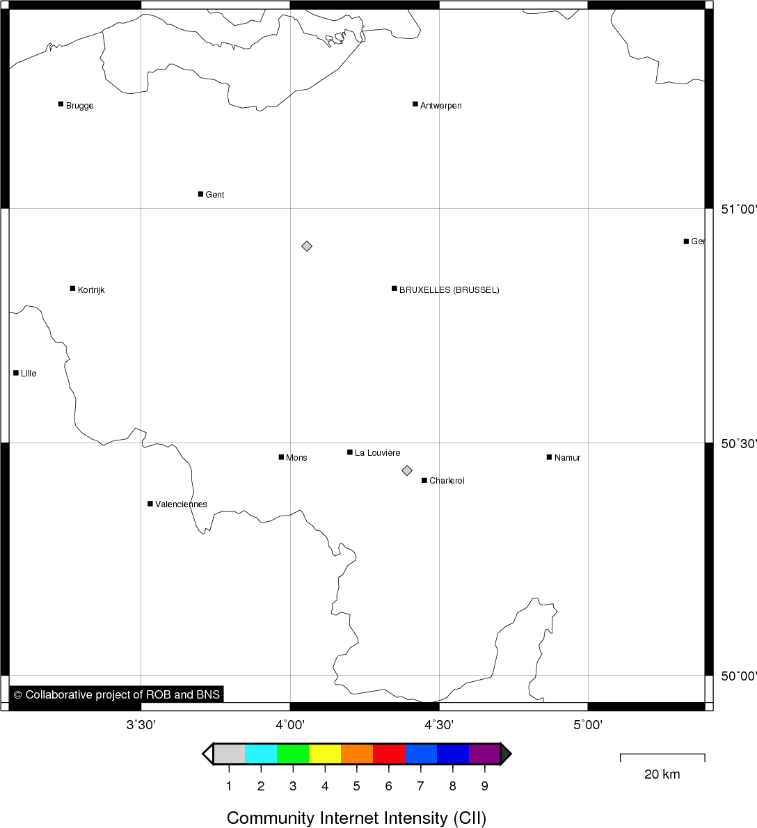
Location map
Quake measurements
Measurements by the Belgian seismic network
| Station | Epicentral distance (km) |
P-Wave arrival (hh:mm:ss.ss) | S-Wave arrival (hh:mm:ss.ss) | Maximal ground displacement (nm) |
|
|---|---|---|---|---|---|
| Code | Place | ||||
| VIA | VIANDEN | 93 | 09:29:52.10 | 09:30:03.96 | - |
| KLB | KALBORN | 92 | 09:29:52.16 | 09:30:03.40 | - |
| MEMS | MEMBACH | 100 | 09:29:53.98 | 09:30:04.95 | 46 |
| MEMH | MEMBACH | 100 | 09:29:54.01 | - | - |
| WLF | WALFERDANGE | 114 | 09:29:55.07 | 09:30:09.43 | 36 |
| EBN | EBEN-EMAEL | 129 | 09:29:58.32 | 09:30:13.36 | - |
| CLA | CLAVIER | 146 | 09:30:00.99 | - | - |
| RCH | ROCHEFORT | 153 | 09:30:01.74 | 09:30:18.58 | - |
| GES | GESVES | 161 | 09:30:03.02 | 09:30:22.04 | - |
| MRD | MAREDSOUS | 184 | 09:30:06.87 | 09:30:28.03 | - |
| DOU | DOURBES | 198 | 09:30:07.00 | 09:30:30.19 | - |
Macroseismic
Data
| Total number of responses | 2 |
|---|---|
| Intensity I | 2 |
Attention! The intensities derived from the macroseismic enquiry are raw unverified data.
Map
Data policy
Please read on this notice to learn more about our data policy.